
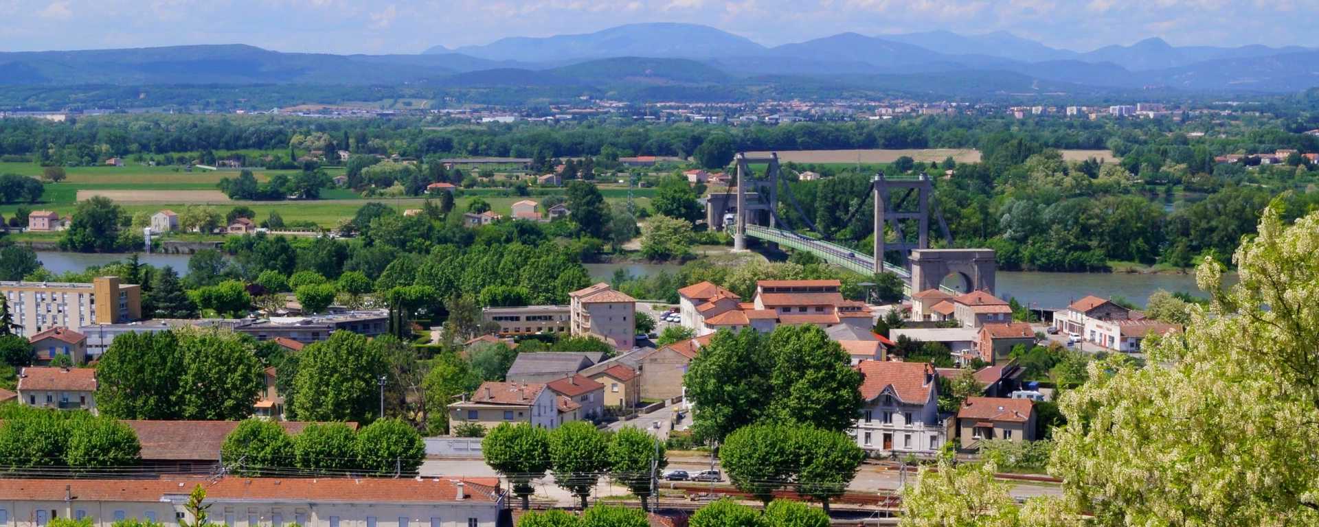
Le Teil is a commune in the south of the Ardèche, situated between Viviers to the south and Meysse to the north, on the banks of the River Rhône, opposite Montélimar in the Drôme, and crossed by the D86 road.

Le Teil: Map, statistics and links
- A commune on the right bank of the River Rhône
- Town in the Ardèche Rhône Coiron Community of Communes
- Population: 8,812 (2022 figures): inhabitants of Teill (demonym)
- An area of 26.59 km², giving a population density of 331 inhabitants per km²
- Altitude from 55 to 460 metres
- Postcode: 07400 / INSEE code: 07319
- The local council’s website ↗
- INSEE statistics ↗
- Introduction to the city, Wikipedia ↗
- Ardèche Tourist Office: Porte Sud Ardèche Tourisme
- Where to stay in Le Teil ↗
- Transport in the Ardèche
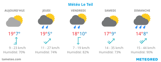
Weather in Le Teil
5-day weather forecast for Le Teil in the Ardèche, including sky conditions, temperatures, wind and rainfall:
Where to stay in Le Teil?
Are you looking for a hotel, a holiday let, a B&B or other accommodation in Le Teil for a night, a weekend or a stay in or around the town? Here’s how to search and find what you’re looking for, depending on your needs and budget:

Where is Le Teil?
Interactive map and location of the commune of Le Teil in France: